
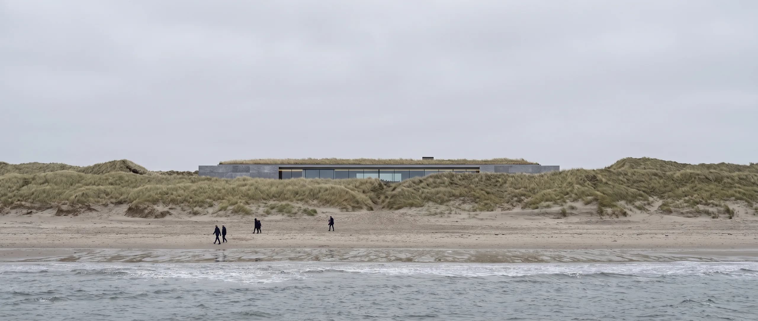
The place
Between farmland and the North Sea.
The Dune can only become credible when it is understood in relation to the actual landscape, ownership, access, protection and planning context of Borestranda.
Early concept illustration, not a final design or planning proposal.
High sky. Long horizon. Working land.
Jæren is not a wilderness image detached from everyday life. It is a cultural landscape where farming, settlements, roads, recreation and protected coast meet within a narrow geography.
The Dune should celebrate that whole relationship. Food, materials, employment, transport and public access must connect the project to the lived region, not only the beach view.
Borestranda.
Borestranda is a long, fine-grained beach extending from Hodne toward the Figgjo river mouth. It is used by surfers, swimmers, walkers and visitors throughout the year and is an official stop on Norwegian Scenic Route Jæren.
The open horizon is the central spatial quality. Any major project nearby will therefore be judged not only by its footprint, but by how it appears from long distances across a flat and sensitive landscape.
A location under study
58.801930, 5.552718
The point is used to test an initial orientation concept. It is approximately 355 metres from the official Borestranda Scenic Route coordinate.
It does not prove land availability, ownership, zoning or development rights. The project requires cadastral mapping, landowner dialogue and professional overlay of current planning and environmental data.
What this coordinate is not
- Not a confirmed building site
- Not evidence of land control
- Not a zoning or planning position
- Not a fixed building footprint
One orientation must govern every plan and image.
- West
- North Sea, sunset, The Heart opening and principal guest views.
- East
- Arrival, road connection, service, staff and technical functions.
- North and south
- Hotel wings, landscape continuity and secondary views.
Every future visualisation must carry a verified north arrow.
Interior and aerial images must not contradict each other. The concept illustrations on this site were produced against a fixed orientation description for exactly that reason, but they remain illustrations rather than survey-based models.
The best image is not automatically the best site.
At least three site scenarios should be compared, and each evaluated against the same criteria.
- Redevelopment or partnership within an existing tourism property
- A larger inland footprint near the current study point
- An alternative location with lower landscape and planning conflict but a maintained sea connection
Comparison criteria.
- Landowner interest and site control
- Existing legal land use
- Protected landscape and biodiversity
- Agricultural impact
- Distance from shoreline and visual exposure
- Road, utilities and emergency access
- Capacity for 100 rooms and a destination spa
- Ability to retain public beach access
- Cost and planning risk
The coastline is protected for a reason.
Norwegian planning law gives special protection to the 100-metre belt along the sea. The prohibition is not absolute, but land use should be clarified through municipal or zoning planning rather than individual dispensations.
In addition, much of Jærstrendene is protected as landscape, plant or bird conservation area, managed by the County Governor of Rogaland. Exact boundaries and applicable regulations must be overlaid by qualified professionals.
The Dune must therefore begin by identifying where development should not occur.
Required verification.
- Exact shoreline reference and 100-metre line
- Protected-area boundary
- Municipal plan purpose
- Applicable zoning plan
- LNF and agricultural status
- Registered property boundaries and owners
- Flood, storm surge and erosion
- Natural habitat and species
- Cultural heritage
- Landscape and viewshed
- Utilities and road capacity
A destination cannot be sustainable if every visit creates unmanaged traffic at the beach.
The mobility strategy should distinguish between overnight guests, employees, spa day visitors, restaurant guests, deliveries and public viewpoint users.
- Controlled arrival from inland
- Hidden or structured parking within the developed footprint
- Electric shuttle from rail or regional hubs
- Transfer from Stavanger Airport
- Coach management
- Staff transport plan
- Safe walking and cycling connections
- Universal access
- Seasonal visitor management
- No spillover parking in vulnerable coastal areas